Friday, 28 September 2018

Clent Hills Camping & Caravan Club Site, Romsley, Worcestershire


Here we are in the Midlands, set up in a delightful club site, so very rural despite its proximity to Birmingham of which Halesowen is a satellite town. But I have jumped ahead of myself, because when I last posted to this blog, we were still in Northern Ireland.

The night before we left our camp near Markethill, we became involved in a family crisis back in New Zealand, and with the wonders of technology, matters could be co-ordinated in New Zealand from a farmlet in Ulster. While we suffered that terrible sense of helplessness, when our personal presence would have been preferable, we were still able to be part of the situation. Needless to say, with time differences from the other side of the world and worry, sleep was scant, and we were up before the crack of dawn to address our own challenges of the day.

We were on the road south all too early, soon across the border into the Republic and on down the M1 past Dundalk and Drogheda, here faced with a small toll charge, then on through the Dublin port tunnel where we paid another toll, this the €10 we had been so horrified to pay when first arriving in Dublin. Again we were early at the Stena ferry terminal and waited for some time in the car along with dozens of other early birds reading our e-books before eventually disappearing into the bowels of the Stena Superfast X, their newest vessel 203 metres long which can carry five hundred cars and up to 1,200 passengers. The day was fine, the conditions relatively calm and having taken a couple of seasick tablets in a timely manner, we arrived in Holyhead at 6.15 pm after a three and a half hour uneventful voyage. 

It was after 6.30 pm that we finally disembarked, and by the time we reached our little certified site at Llanfachraeth near Valley, dusk had fallen. Our hostess came out to meet us as we arrived and directed us to our camp site, leaving the choice of grassy field or gravelled hard stand to us. Chris chose the field thinking he would be able to leave the caravan hitched up for a simple getaway on the morning. Alas the field was very sloping and after driving in several circles trying to find a level spot, we parked up, unhitched and levelled with a series of high blocking systems, by which time darkness had arrived. There we were fiddling about in the dark not able to see the hole in which to insert the brace for lowering the legs. Chris suggested I fetch the torch, but this was near the bed, at the back of the van and without the legs down, not accessible. Eventually we were done, making do with jerry cans of water rather than setting up the whole water tank system. Meanwhile we were ankle deep in freshly cut grass, trudging it into the van despite our efforts to keep the interior clean and tidy. Finally we were set up well enough to cook dinner and settle in for the night. I went to bed as early as circumstances allowed and slept like a log.

This morning with a long journey of about 180 miles ahead of us, we were away promptly, after lowering the caravan back down to a towable level and waving farewell to Mavis who watched us from her front window. 

Halfway across Anglesey, as we descended from what little upland the island has, with the skies above clear, we had the most splendid views toward Snowdonia. Soon we crossed the Britannia Bridge to mainland Wales and continued on across the northern coastline on the A55, a road we travelled twice before crossing to Ireland at the end of July. We pulled over to check our route when I realised that the M56 would take us further north than we needed to be, however when we considered what appeared to be a more direct route, the mileage was only marginally lower and the time longer. We reverted to Tomtom’s Plan A and continued on until we intersected the M6, turned south and continued on until we turned onto the M5 west of Birmingham before turning again toward the Clent Hills in which we are camped. 

At least half of the distance travelled on the M6 was through road works where the speed limit was down to 50 mph and the traffic often reduced to a crawl. The congestion was probably not helped by the fact that the M40 was closed to traffic all day after a couple of horrific accidents early in the morning involving several trucks and one fatality. And of course we are back in England where the traffic is one hundred times that of New Zealand or Ireland.

My main efforts for the rest of the afternoon after setting up camp were concentrated on several bags of laundry, the last lot having been done when we were in Coleraine; needless to say we carry a large amount of underclothes and socks. We are here for a couple of days; the forecasted fine weather should complete the drying process and offer opportunity for a successful outing, yet to be decided.

Despite the mutterings by the television weather girl about the cold, after Northern Ireland we find the weather almost tropical. I am wearing half the amount of clothing layers.

Wednesday, 26 September 2018

Teepee Valley Campsite, Markethill, County Armagh, Ulster


I think I’m losing my touch as regards tour organisation; today we found ourselves again frustrated with bad planning, closures and inconvenient weather conditions. This was our last full day in Northern Ireland, in fact our last full day in the island of Ireland and should have been more memorable.

After popping into that excellent supermarket in Markethill for a couple of items, we headed south deliberately staying off the roads already travelled, soon arriving at Bessbrook just north of Newry. 

This little village, today with a population of just over two and a half thousand, was founded by a Quaker linen entrepreneur in 1845 the design of which was followed by the Cadbury family ‘s Bourneville estate  in Birmingham. The Richardsons from the Lisburn area acquired the mill and fifty acres of land and began a flax spinning, weaving and bleaching enterprise on the site. In association with this Richardson developed the housing beyond that which already existed, into the Bessbrook that exists today, with its two open plan squares and other terraces with granite rubble or stucco facades. It was his opinion that the lifestyles of people could be influenced by their environment and his scheme included facilities for education, a health service and recreation. Respect for cultural and religious differences was encouraged. Stone working and farming as well as the building and maintenance of the expanding village provided a wider range of employment opportunities than linen manufacturing alone. Richardson believed that alkcohol was the main cause of poverty and crime and so there was to be no place for the sale of alcoholic beverages and therefore no need for either pawn shop or police presence. Bessbrook became known as “the village without the three P’s”

 
The National Trust has owned and managed Derrymore House and the surrounding parkland since 1952, a wonderful area open to all and today that was one of our destinations. 

We had understood this estate was situated off the High Street in Bessbrook, and we spent some time driving and walking around looking for it, finally giving up and decided to head on to the next attraction. We headed south again, now toward Camlough, and lo and behold, we passed the Quaker meeting house and the entrance to the demesne; how lucky was that!

Of course we immediately reverted to Plan A and drove up into the park, full of mature trees turning with the season, a mass of autumnal colour. We parked up behind Derrymore House, understanding that it was not open to the public today but still keen to poke around as much as we could.

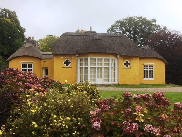
After a half hour walk up into the woods and about the meeting house, which is locked up tight because of years of vandalism , and the graveyard very plain by British standards, enjoying the birdlife, the conkers and the wonderful clusters of fungi, and of course the fresh air and opportunity for exercise. On our return we wandered around the yellow thatched house, delighting in its charm and quirky colour. 

We learned that Derrymore House was built in the 18th century for Isaac Corry, who represented Newry in the Irish House of Commons for thirty years from 1776. This was before it came into the ownership of the Richardsons in 1859. It was during the Corry years, more particularly in 1800 that the Act of Union between Great Britain and Ireland was drafted in the drawing room (now known at the Treaty Room). Thus the house is of great historical significance.

Back on the road, we pressed on to Camlough then turned south again following a minor road between Camlough Mountain which stands 423 metres ASL and the small mountain range that is dominated by Slieve Gullion which stands 577 metres ASL. Between these lies a sliver of a lake, Camlough Lake, which we hoped to access and wait out the mist that had descended upon all the high land about us. Alas it seems that all the land that surrounds the lake is privately held, so we pressed on now wondering at the wisdom of driving up into Slieve Gullion Forest Park. We followed signs until we reached one that stated the entrance was 165 yards on the right. At first we were unable to see the entry; it seemed to be a thick hedge. Then we realised that it was the foliage of a massive tree that had fallen, and in fact somewhere through the mass, there was the whine of chainsaws. The decision had been made for us; we would not be visiting the mountain top, or walking the trails through the forest. 

We pulled over to discuss our options and decided to head west into County Monaghan in the Republic. We set the Tomtom for Crossmaglen initially, a rural service centre still inside the UK which boasts the largest market square in Ireland and saw serious violence during the Troubles so very near the border. During the Troubles, at least fifty eight police officers and one hundred and twenty four soldiers were killed by the provisional Irish Republican Army in South Armagh, many here in Crossmaglen itself. 

Alas we ended up in a veritable maze of narrow farm lanes; whoever programmed Crossmaglen into the device absolutely screwed up. We reset it for Castleblayney across the border, having to switch maps to do so. The new route took us through Crossmaglen but by now we  had lost any desire to check it beyond a passing glance. 

Very near the border we pulled over beside Lough Muckno and lunched while watching a fisherman catch and return several small fish. He had come with so much gear for his comfort and convenience that it would surely take him half an hour to reload his car.

At Castleblayney, we found a park inside the Hope Castle estate, near the lake shore and walked up into the town, a scruffy affair, yet full of local people going about their business. We were fascinated to see so many of the shop windows full of displays all about Big Tom. Turns out Tom, Tom McBride, a popular Irish country singer, who was born here in 1936, died this last April, and the town has made the most of its connection, with festivals to celebrate his music and already had a statue erected near the rather derelict town hall, which is already attracting Big Tom’s fans.      

Down by the lake, we wandered about to explore the castle and the mass of waterfowl. Lough Muckno which is about 425 hectares is the largest and apparently most scenic of the County’s many lakes. 

The Castle was built by the Blayney family, hence the town’s name, but before them, the MacMahons ruled the roost hereabouts and had done so for a couple of centuries.  Sir Edward Blayney was granted permission by King James in 1612 to build a large castle and establish a midway stop for soldiers and communication between Monaghan and Newry. In 1641 the castle was attacked and captured by Hugh MacMahon, although the Blayneys eventually took it back again. However it was not until 1779 that the estate and newer Napoleonic mansion were developed on the site. Then in 1853, the demesne and castle was sold to Henry Thomas Hope who carried out extensive renovations and renamed the site Hope castle. And it is these Hopes who are connected to the Hope Diamond, which is world famous for those with encyclopaedic interest.

The Hopes continued to live in the castle until the early 1900s then in 1928 it was sold and later occupied by Franciscan Nuns on up until the mid-1970s when it was purchased by the Monaghan County Council who in turn leased it to several business people, the most recent a hotelier. It was during this incarnation, in 2010, that the castle was attacked by an arsonist, the evidence of which we saw today.

We lingered on the shore watching and listening to the very vocal ducks before retiring to the brilliant children’s playground where we briefly played on the flying fox; so much fun! After such excitement it was time to head home so we drove north east back into the UK and through lovely farmland back to our campsite. 


Tuesday, 25 September 2018

Teepee Valley Campsite, Markethill, County Armagh, Ulster


You would think that by now we would be more wary of weekday openings especially now the peak of the holiday season is over. I had a full day planned for the day, the activities taking account of the  weather forecast; a city and two National Trust properties should more than fill the day and well please us. But over breakfast I checked our National Trust directory and found that both Ardress House and The Argory were not open during the first and middle part of the week. So I cast my net a little wider and The Chauffeur agreed we should visit the heritage attractions before proceeding in to the county town of Armagh.

We headed firstly into our local village, Markethill, a surprisingly populous and busy centre. With a population of less than two thousand, it fills up three times a week with punters coming for the livestock market, and even more so once a year during the summer for the world’s largest Lambeg drumming contest. A Lambeg drum is a large Irish drum beaten with Malacca canes and is played in the Unionist and Orange Order parades; another antagonistic festival. We called into the excellent supermarket in the village, inspected the wares to find them a little pricey and settled for the day’s newspaper.

Ten or so kilometres north-west we found ourselves in apple growing country, an agricultural activity that had been going on around Loughgall for many centuries. Apparently William of Orange sent his cider maker in advance to make cider to quench the troop’s thirst before the Battle of the Boyne and legend has it that St Patrick swung by here as well. Certainly today we saw acres upon acres of apple trees, most heavily laden with ripe or almost ripe fruit, and alas, thousands upon thousands of windfall apples lying upon the ground. But in truth I was surprised that there had not been greater devastation wrought by the storm of last week; we had seen uprooted trees and broken branches as we drove up through the county. 

Soon the brown tourist signs directed us to the site of the Battle of the Diamond which took place in 1795. This was a skirmish between the Protestant Peep O’Day boys and the Catholic Defenders, a culmination of a long running dispute about control of the local linen trade. The Protestants came off best with their opponents losing thirty of their number. The glory of the victory gave rise to the Orange Order  and the first Orange Lodge march took place the following year, and as we well know, have continued on through the centuries.

Almost across the road from the battle is a farmhouse owned by the Winter family, advertised as Dan Winter’s Cottage, where we hoped to learn more about the battle, the life of the people here at the time and the Order. We arrived a few minutes early, and sat outside until several minutes after 10.30 am. Entering the property, farm dogs barked and we caught sight of a farm worker fussing about his business up the other end of the yard, but no sign of attention for the visiting tourist. We hung about for some time, finally returning to the car without satisfaction and no better informed.

Instead we headed south on through the apple orchards to Armagh, and found a park beneath St Patrick’s Church of Ireland Cathedral, before heading down into the Market Street. While the rain stayed away until we arrived home, the wind was so very cold. We did not even attempt to call in to the Anglican Cathedral, this high on the hill central to the town; we had already read there was a fee involved and you know what we think about this.

The Mall, a tree lined long narrow park running north south below the retail area, is quite charming, lined with handsome Georgian house designed by Armagh born architect Francis Johnston, who worked mainly for Archbishop Robinson, of whom we were to learn more later.

The Armagh County Museum is situated in a former schoolhouse on the east side of The Mall and is quite delightful. Opened in 1937, it was the first county museum in Ireland and I am sure than many of the interpretative cards date from that time. However while there is little modern about the curatorship of this museum, it is concise and held our attention for some time.

One of the exhibitions was all about the railway which no longer passes through Armagh, recounting Ireland’s worst railway disaster which took place in 1889 close to the city. The accident was the result of a collision between a special Sunday excursion on the way to Warrenpoint (passed through yesterday) and the oncoming passenger train bound for Newry. Over one thousand people were packed into thirteen carriages, all locked tight to prevent non-ticket holders getting onto the train.

On a steep hill outside Armagh, the train stalled, so the decision was made to divide the train into two, leave the second half chocked and waiting for the engine to come back for it. So off the first part went chuffing up the hill without hindrance. Alas the waiting carriages rolled backwards gathering speed as it went and collided with the oncoming train. Eighty nine people were killed and over four hundred suffered terrible injuries; indeed a terrible disaster which is well memorialised here.

There is also much about the linen industry which monopolised the economy, for centuries in fact, beginning with cottage industry before moving into the towns and cities where large factories were set up. Records from as far back as 1430 mention linen production, and by the late 17th century, the linen trade of Ireland was encouraged at the expense of the woollen business, to the great hardship of the country as a whole. Of course the last century brought new synthetic materials and cheaper mechanised ways of producing other fabric, even if not as exquisite as that produced in Armagh during the 18th and 19th centuries. This too is all part of the history of hardship endured by the folk who inhabit this island.

As we emerged from the upper floor of the museum, the other galleries currently undergoing set up of new exhibitions, we were accosted by the volunteer behind the desk, a most unlikely looking chap, a ruffian in fact, but a man of great passion for and knowledge of his county’s history. He told us how Armagh is like Rome, built on seven hills, a fact I have yet to verify. He told us too about the wonderful Archbishop Robinson, who unlike many of his ilk, spent his income on the people of the parish rather than squirreling his wealth away.

I was curious about this great benefactor of Armagh and later learned the following: that he was born Richard Robinson in 1708 and in 1777 created 1st Baron Rokeby. Brought up and educated in England, he first came to Ireland in 1751 as chaplain to the Duke of Dorset.

Six years before entering the Peerage of Ireland, he founded the Amagh Public Library, three years later the County Infirmary, then six years after that donated land for the erection of the new prison. In 1790 he founded the Armagh Observatory as part of his plan for a university in Armagh however he died four years later without realising that dream. Apparently he left money for establishment of the university; however this has never come to fruition even after all these years. Instead Coleraine was given that privilege in 1968 much to the consternation of the likes of our scruffy informer.

Interestingly Google reported that Robert Walpole called Robinson “a proud but superficial man” and John Wesley accused him of being more interested in buildings than in the care of souls. It is curious as to how people are remembered after they have died.

Another of the buildings Robinson left for perpetuity, or at least until it crumbles to the ground, is the Archbishop’s Palace located on three hundred acres of parkland on the southern edge of the city, and the primary residence of the Anglican or Church of Ireland Archbishops of Armagh for over two hundred years. Since 1975 the Palace has been headquarters of the Armagh City and District Council and according to our guide book is open for guided tours. This is not strictly true as we were to find out for ourselves.


We returned to the car and drove to the Demesne Palace gardens, up past the friary ruins and parked within view of the grand house. A charming young woman met us at the door and indicated that we were welcome to make our way around the hall, stairwell and passages to view the paintings, but not to venture into any of the rooms. So we did as we were told and enjoyed the current exhibition of local artist J B Vallely, whose work we absolutely loved. Back in the foyer, the receptionist took us into the Armstrong Room, the Lord Mayor’s Parlour, formally the dining room of the Palace. It is a lovely room where the Lord Mayor, currently Julie Flaherty, meets and greets special people or holds mayoral gatherings, fit for any fine home. 


We checked out the stables which now house the registrar of birth, death and marriages and a restaurant. Out in the garden amongst the chestnuts where we spotted the first conkers of the season and two busy grey squirrels, is a sensory garden that has seen better days. The pond and fountain have not seen water for a while; perhaps the earlier drought conditions were cause to close it all down and no one has got around to restoring everything to order.

Back on the north side of the city we called up to the St Patrick’s Catholic Cathedral, this also situated on top of a hill, almost in competition with the Church of Ireland. It is a stately building with the most stunning interior.

Construction began in 1840 after the Catholic Emancipation, and continued on right through to 1904. In more recent years restoration work has taken place, but the basic structure has remained unchanged. Many archbishops held office during construction, and many died according to the list within the church. We were very impressed with the intricate mosaic tiling work throughout. I was also very pleased to learn that building work was suspended during the Famine years and funds were diverted to fund relief, a story at odds with most practice of the time.

On our way home we detoured up to the Seagahan Dam where we found the reservoir here also short of water. Most searches for statistics about this just turned up information on the brown trout with which it is well stocked, although I do worry about their reduced habitat.

As we turned away from Markethill toward our campsite, I remarked that we had been lucky with the weather, jinxing the status quo; drizzly rain commenced. However the weather forecast for the coming days is looking pretty good; we just need to stay well wrapped up.


Monday, 24 September 2018

Teepee Valley Campsite, Markethill, County Armagh, Ulster


Sunshine and buffeting winds accompanied us on our drive south yesterday, heading first westward on the M1, before turning south and on through Portadown and Tandragee, and finally west again on the minor B3 into the Cusher valley to our little campsite here on a farm. From our caravan we have views down toward the river, across recently re-sown fields which accounts for the bird-scarer cannon blasting away yesterday. 

Speaking of blasts, we never did identify the gunshot or blasts heard when we were camped at Larne, even by asking the employee in the service station opposite the camp or another in the Asda supermarket who said he lived in the city. The former did mention that she had been asked the same question by other campers; I had wondered if the occupants had become so immune to such sounds over the years, they now no longer heeded them.       

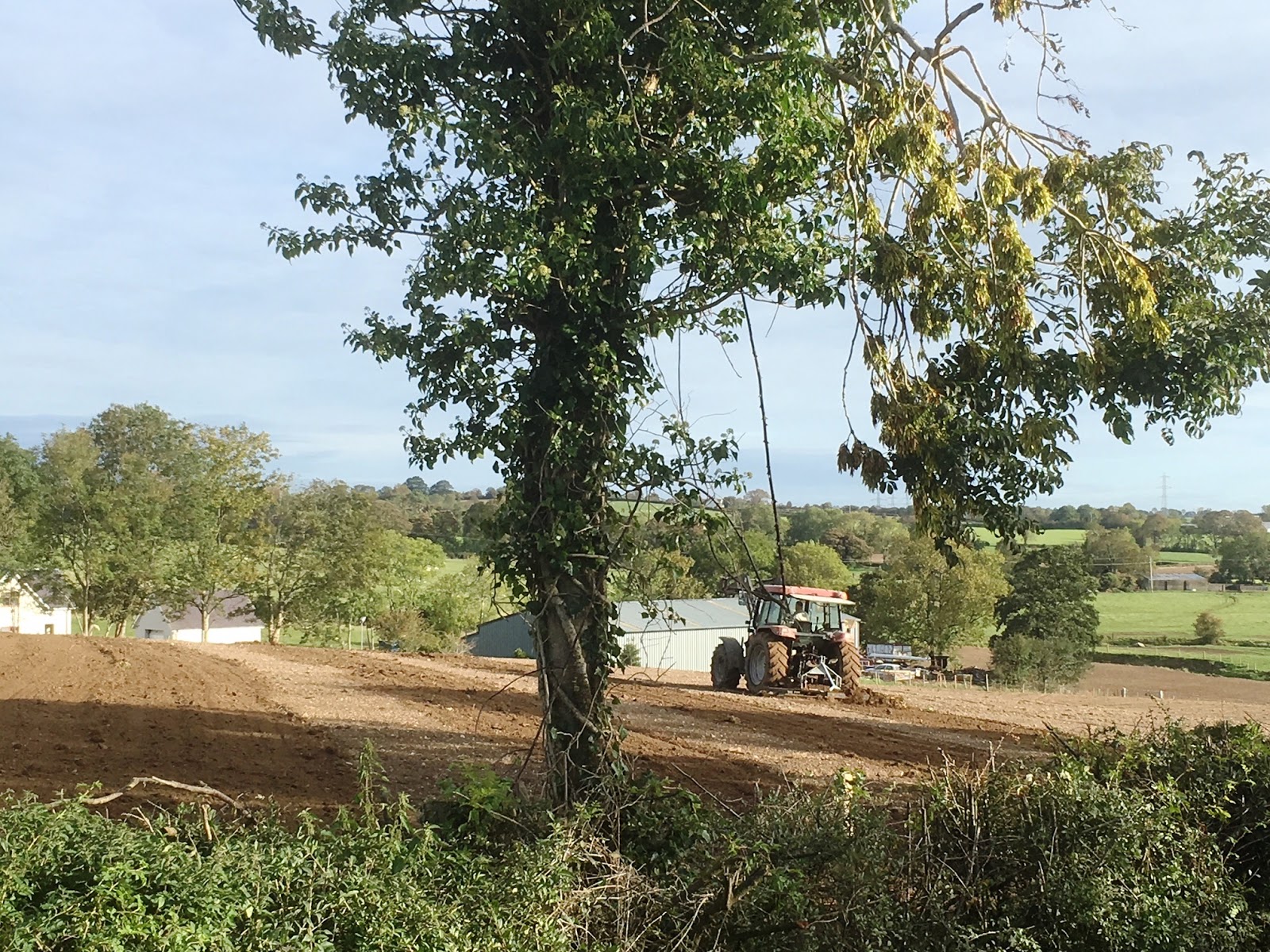
This morning the farmer arrived in the next field while we were still having breakfast, driving his tractor back and forth, harrowing the ploughed field, and then this afternoon, he repeated the process.

We headed away into County Down to explore the Mountains of Mourne, which most folk who enjoy listening to Irish ballads will be familiar with. Our route took us south to Newry through a tangle of motorways and highways, then eastwards on the B8 to Hilltown, before heading south through the mountains on the B25. The road rose up over a saddle, past a small plantation of pines that had been decimated by last week’s storm, then down to Rostrevor on the Carlingford Lough, a very picturesque descent toward a waterway more like a fjord than your run-of-the-mill bay. The village is built on the steep lower slopes of Slieve Martin and while we passed quickly through the business end of the settlement, we did pause at the Lough edge to take in the serene scene and the Republic’s highlands across the water.

The Chauffeur had been instrumental in plotting the day’s route after my general suggestions, and so I was delighted that he was keen to zigzag all over this range to see as much as possible, a route I would not have dared suggest. He did ask me to calculate the distance accepting that it might end up to be an absurd day’s outing, however when I advised it to be a little over one hundred miles, he was quite satisfied.

Having come south, we then pressed on eastward along the A2, on down the Lough, through Kilowen, across the north head to Kilkeel where we headed north once more, following the B27. Spotting a sign indicating a detour to the Silent Valley, we headed off along narrow farm lanes, finally arriving at the entrance to the Silent Valley Reservoir and a sandwich board advertising the entry fee. It would have cost us £4.50 to drive in and while this would have been absolutely reasonable had this been the one destination of the day and we were planning to walk about the area around the 674 metre high Slieve Binnian. Alas we were not; we had been drawn particularly by what appeared to be a straight wall built all the way to the top.

Perhaps if we had gone on into the Silent Valley park area, we might have learned about this wall, but it was not until we returned this evening that I did a little research and found this to be even more astounding that the vision that had met us today.

The Mourne Wall was constructed between 1904 and 1922 by the Belfast City and District Water Commissioners to enclose a catchment area for the purposes of providing water for Belfast and most of County Down. The granite wall, crafted from the stone of these mountains, is about one and a half metres high and a little under one metre thick, and passes over fifteen mountains.

Looking at just this one section on the side of Slieve Binnian, we joked about the problems that might be encountered building it; exhaustingly carrying the stones up the steep hill, then having one or two or more roll down to the bottom after all that effort. When one considers the extent of the wall, surely such problems must have arisen, and I doubt they were considered comic.

Returning to our original route up the B27, we climbed up over the slopes of Slieve Muck, soon arriving at the Spelga Reservoir. The Spelga Dam, 350 metres long and 30 metres high, was constructed in the 1950s, covering an area known as Deer’s Meadow and the road connecting Kilkeel and Hilltown, the original B27.

I remarked today that the bare shoreline suggested unusually low water levels and later found I was right. The rains we have enjoyed during our travels in the island of Ireland have helped remedy the situation in part. Back in July hundreds of locals visited the dam to walk along the revealed road, some of this still visible today.


We wandered down to the shore and back, the cold wind hastening our retreat. We had risen to 4 degree temperatures this morning and there seemed little improvement during the course of the day. Around the other side of the reservoir, we parked near the dam, which was well fenced off from the general public. We walked down the road to seek views north across the County Down  into County Armagh and back toward Belfast, before lunching in the car and enjoying the views over the water from the shelter of the car.

From here we had planned to carry on up, or rather steeply down, along the same road, but instead decided to retrace our route a little and cross down between Slieve Bearnagh and Craigdoo, 720 metres ASL and 402 metres ASL respectively, and on east along the B180 to Newcastle on the coast.

Newcastle was a surprise, far bigger than we expected. Parking at the waterfront, the promenade stretching attractively east and west of our parking spot, with Slieve Donard, this 852 metres ASL, rising abruptly  to the south, we walked up through the main street, full of closed slot machines premises and fun parlours, and a few scurrying locals and the same number of well wrapped up tourists. We rather liked the place, especially without the holiday crowds and razzamatazz that would surely accompany all that.

The A2, that which runs all the way south past the Giant’s Causeway and on down past Larne, that which we have travelled sections of over the past week or so, carried on from here, now named the Mourne Coastal route, hugging the coast and delighting us in the process.

At Annalong we checked out the harbour only because it seemed remarkable that such a place 
could have space or the conditions for such, surprised to find this tucked away below the village, one of the most sheltered mooring spots we had ever seen. The entrance to this little refuge is via a high walled labyrinth, which might well be tricky if the sea was wild.

Further on we arrived once more at Kilkeel, even bigger than we had deduced earlier. We learned this little town of about seven thousand inhabitants has one of the largest fishing fleets in Ireland. Pity we didn’t check Kilkeel’s  harbour out. Instead we noticed the men of the town were all gathering for a funeral at the Presbyterian Church.

On we went, now passing through Killowen, once more within the Lough and now seeing evidence of fishing vessels. On again and we passed Rostrevor, then onto new ground as the Lough narrowed to such an extent that now at low tide, the river channel down from Newry seems more a paddling pool for wading birds than anything else.

We arrived in Newry, a city of about twenty seven thousand people, just north of the border with the Republic and the scene of several violent incidents during the Troubles, even as recently as 2010, long after the Good Friday Agreement. As we had passed through the northern reaches of the town earlier in the day, we had passed the police station, a great fortressed compound such as those seen in several areas around this part of the province.

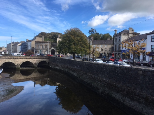
We parked next to the Newry Canal, a body of water contrasting with the piddle finding its way into the Lough. The canal turned out to be something of a surprise, this built in 1742 linking Lough Neagh by the first summit-level canal to be built in Ireland or Great Britain. This explains how naval vessels have found their way into the “land locked” lough in the past, something we had learned of when we walked from Antrim to that Lough a week ago. 
Wandering up the High Street, we found all the retail amenities people would need of such a place, but little grabbed our attention aside from a small greengrocer shop where we purchased a bag of carrots. 

The Newry Catholic Cathedral in this same street rather dominates its surroundings and caused us to stop to take a photo. While doing so we were accosted by a local chap who told us that it had been built on a swamp and the foundations were of wood. I later tried to check this and found nothing to authenticate the claim, however I did learn construction was completed in 1829 and that it was the first Catholic Cathedral in Ireland opened after Catholic Emancipation. I learned too that one can take a tour to learn more about the stained glass windows, the Italian marble altars and other bits but no mention of the swamp or the wooden foundations.

From here it was a quick run home where we found the one fellow camper of last night gone and the site to ourselves and the farmer and his tractor working until the late hours in the dark.