Wednesday, 21 September 2016

21 September 2016 - Onehouse Lakeview Camp, Stowmarket, Suffolk


Goodness knows what woke me early yesterday morning, but I was wide wake long before 4am and my mind spent the next couple of hours making lists, lists of things to do before we leave England, and lists of things to do when we get back, lists, lists and lists! 

I thought too about little gems that I had missed writing up, like the hot air balloon I saw rising above the mist one cold morning when we were at York, or the story of the yew clippings at Castle Howard which were being shipped to Germany to be used in magic medicine for cancer treatment or the pipistrelle bat we saw curled up on the ceiling of the cloister at Durham Cathedral when we were all sheltering from the rain. All of these thoughts, memories and memos swam through my head and further sleep was elusive.

Chris woke early too, although not as I had; we ended up rising with the birds on the hedgerows and were breakfasted, packed up and out the gate by 8.20am. This might have been madness, merging with the work and school traffic, but our route out of the city, or rather, along the ring road, was easier than expected.

So we travelled west on the A64, then south on the A1(M), then onto the M18, then south on the M1 until we neared Rugby, where we turned east onto the A14 which brought is through to Stowmarket. Our route took us across five pages of my road map book and seven hours, although that did include three breaks at service centres along the way; 244 miles in all, at least 44 more than I had originally planned.

As we neared Bury St Edmunds on the A14, Chris just expressing warm fuzzy thoughts for the town that he will always consider his “home town”, the engine stopped, the power steering stopped working and we relived the nasty experiences of the road from Exeter to Tavistock. Fortunately, we were able to roll off the “motorway” down the exit toward Risby, through the roundabout and to a halt beside the road. After a few minutes we were able to restart the engine, proceeding to the turnoff to the crematorium but instead of continuing up to call on family resting places, turned and headed back to the main highway. We continued on through to Stowmarket, without undue acceleration or aggressive overtaking, with no further trouble except that niggling in our heads. 

We fiddled around setting up camp, electing to establish ourselves in a similar position to our first stay here, and it was a full one hour after our arrival that we finally were ready to relax over a cup of coffee. It had been a very long and tiring day, and I hadn’t done any driving! Chris remarked that the distance travelled from York was far less than many of our transfer trips in Australia, but the highways and motorways here in England are far more stressful to drive than the wide open dirt roads of DownUnder.

This morning we woke at a more gentile hour, with nothing in particular planned, no tourist attractions requiring our immediate exploration, although those “lists” had moved from my head to scraps of paper by lunchtime.

We lived a day as normal retired folk do; a little cleaning, visiting relatives, shopping and relaxing before dinner. We have a fortnight ahead of us before we travel down to London for a few days there ahead of our flight back to New Zealand, and while that seems a long time to organise everything, I am sure the days will whizz by. In the meantime, I should flick a few emails off to prepare for the trip across the globe and ready our motorhome there for the next phase of our life.

Monday, 19 September 2016

19 September 2016 - Willow House Caravan Park, York


Again rain reigned the day in so far as we procrastinated, considering all options even to the point of spending the early afternoon in a city cinema. Heaven forbid that international travellers should waste their time with such frivolities! After such indecision, we headed off after 10am, following my original planned itinerary for the day; yet another grand tour up toward the moors. And happily the forecasted rain stayed away. 

Our initial route duplicated that taken yesterday afternoon but in reverse, up the B1363 toward Helmsley back through those charming villages so recently passed and admired, however this morning we travelled a little slower. I had had the impression yesterday afternoon that Chris was hell-bent on returning “home” and had made little effort to enjoy the landscape passing so very quickly. Today he remarked on various features than only confirmed that thought. Today he delighted in the ivy covered red brick cottages of Sutton-on-the Forest as I had the twice before when we passed through.

Arriving in Helmsley, we found our way to the Council car park adjacent to the castle and then spent too long discussing which timed ticket we should buy, disregarding out of hand the “up to one hour” but debating the “up to two”  or “three”. We settled on the lesser of the two and lived to regret it, because Helmsley, even for the tourist unwilling to be drawn into retail or café culture, two hours is far too short. 

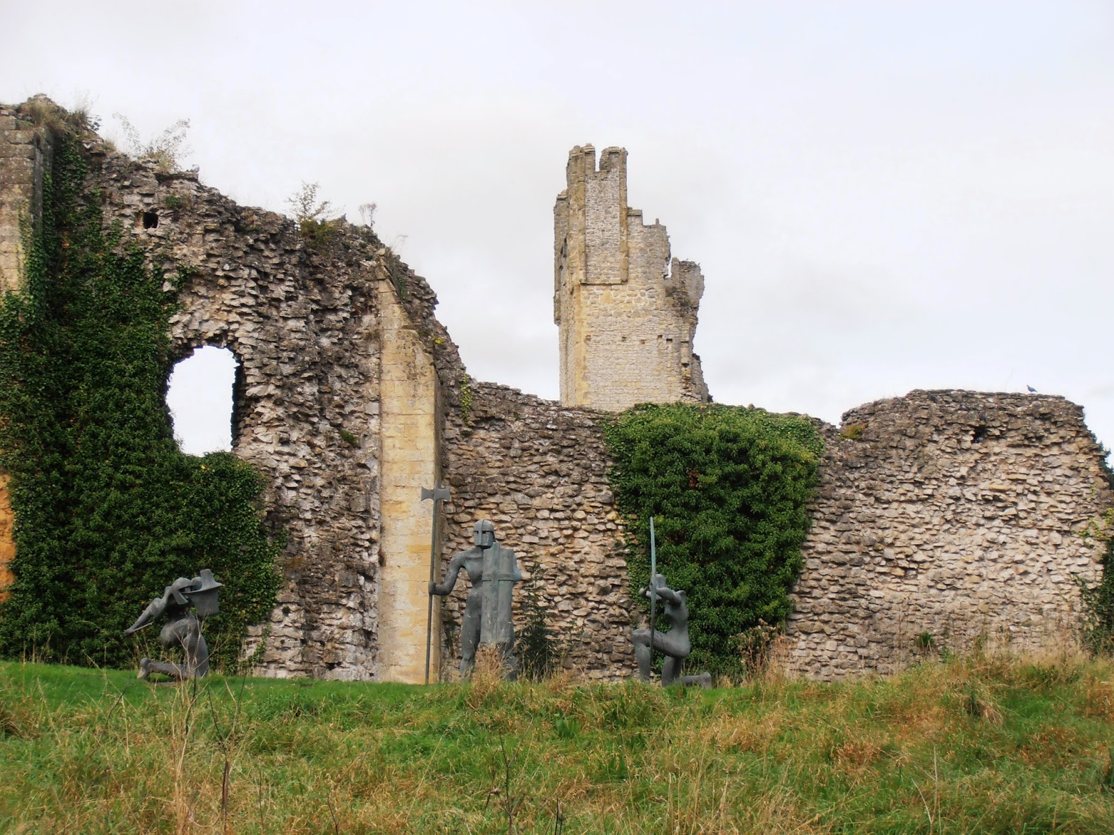
Helmsley Castle is managed by English Heritage and is worth at least the hour and a half we spent there. Most of the stonework defences visible today were raised during the late 12th and 13th centuries by Robert de Roos, one of the twenty five barons appointed to enforce the observance of the Magna Carta in 1215, and his descendants. 

The grandson of that first Robert de Roos, he who fought under King Edward III at the Battle of Crecy in France in 1346, increased the defensive capabilities of Espec’s castle. He added massive earthworks, a tall curtain wall and protruding round towers, the east tower, north and south barbicans and complex gatehouses.

Helmsley Castle
In 1644 the castle was besieged during the English Civil War, defended by a two hundred strong Royalist garrison loyal to King Charles I. From September to November, they held the castle against Parliamentary forces, who had arrived in Helmsley in June that year with seven hundred men on foot and three hundred on horseback. The three month siege that followed was the first time in five hundred years that the castle’s military defences had been tested. 

By the second week in November the castle garrison was running out of supplies. A rescue party sent from nearby Knaresborough with food was attached and captured. Seeing no alternative, the Royalists began to negotiate a respectable surrender, which was duly accepted.

But before these times of trouble, the castle went through years of peace and quiet grandeur. In 1508 Edmund de Roos, descendant of the earlier owners, died childless and the castle passed to his cousin Sir George Manners, who in turn left it to his son Thomas, Earl of Rutland in 1525. When his grandson, Edward, took possession of the castle, he made massive alterations between 1563 and 1587, converting it to a modern residence, a Tudor mansion. He, the 3rd Earl of Rutland had made an advantageous marriage to Isobel Holcroft of Vale Royal, Cheshire, a fact that most likely inspired the redecoration of the interior of the castle rooms.

It was a further descendant and marriage that had it passed to George Villiers, 2nd Duke of Buckingham, who owned the castle during the siege of 1644. 

After his death in 1687, it was sold to Charles Duncombe, he who we “met” at Rievaulx Temples and Terraces yesterday afternoon. Helmsley Castle ceased to be the residence for the Lord of Helmsley shortly before 1720 when they moved to their new baroque country house at Duncombe Park, and instead became a romantic artworks in their personal parkland. In the 19th century, the inner courtyard was landscaped to create tennis courts. It also provided a backdrop for a pageant involving three thousand local people in medieval costume. In short, it had become a place of pleasure rather than a symbol of power.
In 1923, care of the castle passed to State guardianship under the Ministry of Works, who subsequently excavated and restored the castle. The site was cleared of accumulated soil and debris, ditches were emptied of rubble and conservation began on the castle buildings. Then in 1984, English Heritage took over care of the castle.
Views from Sutton bank
As has become our habit, we took advantage of the audio guides on offer and wandered about the ruins and through the restored areas, marvelling at the extent of the property, which far and away exceeded our expectations. Back in the car, near the end of our parking time, we ate our picnic lunch and weighed up whether we should pay for a further hour to explore the town itself or just head off. We elected for the latter, with the default plan to grab a free park should we come upon one as we passed through the town, however it was even busier than yesterday afternoon, a coachload of tourists having arrived. 

Instead we headed west along the A170 toward Thirsk, across the northern extreme of the Howardian Hills until we turned into the National Park Visitor Centre, on the top of Sutton Bank, reputedly with free entry.
How very naive we were to expect the experience to be absolutely free; parking is rarely so, and here the minimum charge is £2.50, for the privilege of walking the short distance to the “finest view in England”, relieving oneself in clean facilities or watching a short video explaining the limestone geology of the area. Needless to say The Chauffeur was not amused, and I was very happy we had not spent further change on parking in Helmsley.

In all fairness, the view was indeed worth stopping for; from the lookout point at 295 metres ASL the landscape stretches out 200 metres below on the valley floor. This escarpment is reminiscent of those we drove up to and looked out from in Australia, something one does not expect in England. On a clear day a huge swathe of northern England is visible, stretching all the way to the Pennines, thirty miles to the west, and despite the less than perfect day, we did enjoy excellent and extensive views today. To the extreme left one sees the Roulston Scar, high above the limestone cliffs that was once occupied by a massive Iron Age hill fort, dating back around 400 BC. It’s the largest of its kind in the north of England and one of the biggest in Britain. Today it is the sight of the Yorkshire Gliding Club. Further north, on Hood Hill, there are the remains of a castle built in 1086 by Robert de Stuteville, a henchman of William the Conqueror, to keep the rebellious locals in check.

Below us most northerly, lay one of only four natural lakes in Yorkshire. This one, Gormire Lake, is reputedly bottomless, believed to have been created when a huge earthquake swallowed up a town, leaving an immeasurably deep hole full of water. The chimneys and rooftops of the town can still sometimes be seen on a clear summer’s night, far below the shimmering surface. Of course none of this is supported by geological fact in the Visitor Centre.

The blackberries were quite delicious here on the escarpment but unfortunately they did nothing to cheer my husband up. But our next little expedition did at least take his mind off the frustrations of bureaucracy, and not only because the parking spot was devoid of parking metres.

Yesterday afternoon we had seen the White Horse high above the highway as we travelled north toward Thirsk. The Kilburn White Horse was cut into the crag in 1857 on the initiative of Thomas Taylor, of Kilburn, and is northern England’s only turf cut figure, 314 feet long and 228 feet high. In 1925 a restoration fund was subscribed by the readers of the Yorkshire Evening Post and the residue of £100 was invested to provide for the triennial grooming of the figure.

Kilburn's White Horse
According to the man in the National Park Visitor Centre, the working bee which undertakes the maintenance every three years clear off weeds, cut back encroaching vegetation and repaint the limestone base, because time naturally darkens the light colour, all with the aid of abseiling-like equipment. We walked up most of the 151 steps alongside the figure, and at such close quarters might have thought it simply to be a landslide had we not seen the whole “artwork” for ourselves from further afield.

From here I was keen that we should continue along the A170, because immediately after the Visitor Centre, the road drops the two hundred metres to the valley floor in a very short time indeed. 
Caravans are forbidden on this road, and so naturally we were keen to see for ourselves how very treacherous the stretch was. Chris decided that it would be perfectly suitable to travel towing a caravan had we electric brakes as in Australia, but here the brakes are over-riders, and an entirely different cup of tea.

We turned back along the base of the hill and drove through narrow country lanes and roads, stopping at Kilburn to photograph the Horse and to watch the progress of a glider before it disappeared out of sight. Kilburn was absolutely delightful, and well worth the detour; we continued on through Coxwald, Oulston and Easingwold, before joining the A19 back to York.

Again we patronised our local Tesco, topping up with fuel and with provisions. We will leave York tomorrow morning, with regret, having had a wonderful time, and with a will to return at some time in the future.

Our route south has been hotly debated this evening, The Chauffeur insisting we take the most major motorways, thus adding  unnecessary distance, in my opinion. However I did state that he should be master these last few weeks here in England unless I have a very real reason to suggest otherwise. We have much to organise as regards preparation and storing of our rig, and catching up with his family, including cousins whom we have totally ignored up to this point of our trip.

Sunday, 18 September 2016

18 September 2016 - Willow House Caravan Park, York


This morning we waited for the mist to rise and reveal a superbly clear autumn day. It was the perfect sort of day to set off for another tour across the moors, but this time on the western side as opposed to the central and eastern section we did from Whitby.

We headed up the A19 from York through Thirsk, then a further ten miles or so before turning into the Mount Grace Priory. Set against the Cleveland Hills which stretch across the whole area we were to explore today, the Priory is amongst the most unusual of English Heritage’s monastic sites, with the bonus of an Arts & Craft mansion, this latter once a lodge for visitors to the priory and the first point of contact when one arrives.

The house owes its present form to Sir Lowthian Bell, a wealthy industrialist, who owned Mount Grace from 1899 to 1930. Originally it was a seventeenth century house, but Bell extended it considerably, and refitted all the interiors in the Arts & Crafts style of the late nineteenth century. He also repaired the ruins of the priory. Ivy and trees growing up over the walls were removed, low walls were repaired and fallen walls around the cloister rebuilt. He also rebuilt one of the original monks’ cells, which have since been restored and furnished by English Heritage.

Mount Grace Priory ruins
However interest in history and archaeology had been expressed by the previous owner, William Brown, a barrister and historian, who inherited the site of Mount Grace from the Mauleverers of Arncliffe Hall. Although he personally never lived at Mount Grace, he transcribed surviving documents of the priory and established its history. He was interested in the ruins and encouraged their excavation, bringing in a leading monastic scholar of the day who worked here extensively from 1896 through to 1900. It was this Sir William St John Hope who uncovered the most complete Carthusian priory remaining in England.

But I am jumping ahead of myself; Carthusians differed from other monastic monks in that they lived a hermit-like existence only venturing into fellow human company when they came to celebrate their various prayerful and spiritual rituals in the church. They otherwise lived without any contact, even to the extent of having their meals passed through an L-shaped hatch by a lay brother. Certainly their little apartments, by the standards of the day, were well appointed with three rooms downstairs, a workroom upstairs, a small garden in a walled courtyard and a toilet complete with plumbing out in the yard but accessed under cover. There have been large families in more recent times who have not enjoyed the luxury of such a living space.

Mount Grace mansion
The order originated in Grand Chartreuse in France, and was apparently revered for its humility and intense spirituality. This particular priory was founded in 1398 by Thomas Holland, 1st Duke of Surrey, the last monastery established in Yorkshire.

Like all religious establishments, it was closed in 1539 and the site passed into private ownership. Sir James Stangways was the first owner of Mount Grace after the departure of the monks, only wanting the property for the land and farms that went with the Priory. He acquired 139 acres of farmland, 100 acres of woods, the home farm, the priory watermill and a guest lodging. In these instances the new owners were expected to destroy the structures with religious connotations; instead he left the priory to decay. It was, after all, the burial place of his parents and grandparents. 

In the years that followed right through to the seventeenth century, the property changed hands several times. Thomas Lascelles bought the site of the old priory in 1653 and it remained in his family until 1744 when it was sold to the Mauleverers of Arncliffe. It was this Thomas who converted the ruins of the priory guest house into the core of the present house, using some of the stonework from the priory ruins. And then came Mr Brown, as above.

Our visit here had been very much a spur of the moment kind of thing, and we were so glad we had called. Apart from the wet recently mown grass clinging to our shoes, we thought the ruins and house just fabulous, and the stories and interpretative panels fascinating. 

Back on the road, we resumed our original plan, soon turning again onto the A172 toward Guisborough, then south through narrow roads to connect with the B1257 which cuts down over the moors through Bilsdale and Ryedale, after climbing up toward Urra, the highest part of the moors referred to when we travelled across further to the east.

Climbing away from the near sea-level area of Teeside, we could see Roseberry Topping, a rather strange shaped hill from which James Cook apparently gazed out to toward the coast as a young boy inspiring him to follow the career that subsequently brought fame and adventure.  We pulled into a layby, already packed with cars, hoping we could easily walk to a vantage point to take in even more extensive views, and instead found ourselves on the Cleveland Way National Trail, a 175 kilometre walking route from Helmsley to Filey Brigg. 

We were not interested in setting out along this, and old stone walls hid the views we were seeking, but we were delighted to find ourselves at the finish line of a rather extreme mountain biking stage down over the moor. We chatted with the marshal when opportunity allowed as he was busy after all, and watched as these crazy cyclists came blatting over the fern covered hill and down an extremely rough stony track, straight into the bank beneath us. Several of them yelled an unrepeatable expletive as they came down, but then having caught their breath, said it was awesome and wanted to do it all over again. It was the marshal’s job to hustle them on to the next stage, warning them they were coming straight out across a busy road.

View up Bilsdale from Newgate Bank
We walked a little further up, high enough above the scrubby wall to look north, before turning back to the car and continuing on, now descending into the wide and lovely valley of Bilsdale. We stopped for lunch in a forest picnic area, at Newgate Bank, a most un-English spot because the parking was free, although the facilities were nil apart from a rather well appointed lookout tower from which I took a few photos.

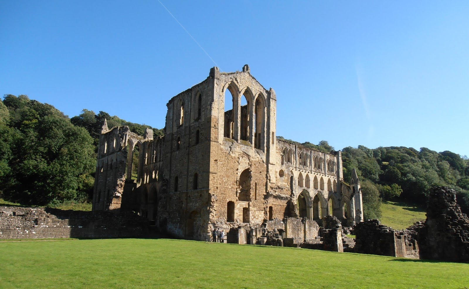
Soon we reached Rievaulx and came down to near the river, parking by the abbey ruins. The abbey, founded in 1132, was the first Cistercian abbey to be established in the north of England. It quickly became the most powerful and spiritually renowned centres of monasticism in Britain, and in its heydays of the 1160s, home to a community of 650.

In 1220 the east end of the church was rebuilt to house the relics of Aelred, the third abbot who like the founding abbot, William, lived a life so holy, was made a saint.

Views of the Rievaulx abbey ruins
The abbey was at the hub of a trade network that extended as far as Italy. Fleeces from the abbey’s flocks were highly prized and Rievaulx became very rich. The period from about 1270 to 1400 was one of change and often difficulty; in the late 13th century, epidemics devastated the abbey’s flocks, leaving the monastery in debt. The abbey itself was badly affected by warfare between England and Scotland and was pillaged by the Scots in 1322, and then the Black Death in the middle of the 14th century also took a heavy toll. In 1380 there were only fifteen monks and three lay brothers left at Rievaulx.

The abbey fell victim to Henry VIII’s destruction of the monasteries, just as all the rest did, this one suppressed as late as 1538. The monks were cast out but did receive pension. Rievaulx was sold to Thomas Manners, Earl of Rutland, though the plate, bells and lead from the roofs were reserved for the king. Documents from the time reveal that Manners was determined to extract everything of value from the former monastery, which was stripped of its contents and rapidly reduced to ruins.

In 1687 the 2nd Duke of Buckingham, whose father, George Villiers, had acquired the Rutland’s Yorkshire estates by marriage, sold Rye Valley and many of Rievaulx’s former estates to Sir Charles Duncombe, a London banker. Duncolme built a new house, Duncombe Park, on the west side of Helmsley, which lies two miles to the south of the abbey ruins. The park was further extended along the Rye Valley in the 1750s by Charles’s nephew, Thomas Duncombe, who created a terrace above the abbey with Classical temples at either end, in the style of that at Castle Howard.

It was this and the resulting reputation that triggered interest in the ruins, and from the late 18th century, the abbey became an increasingly popular destination of visitors. By the mid-19th century the interest had become more scientific or historical, rather than artistic, and the ruins came to be appreciated for the archaeological evidence they contained. 

Rievaulx Temple
By the beginning of the 20th century, the abbey ruins were in a state of imminent collapse. Minor repairs were carried out in 1907, but the scale of repairs needed was such that only state intervention could save the site. The Office of Works took the ruins into guardianship in 1917. Immediate repairs were begun, despite the shortage of resources in these war years, and then in the 1920s, removal of much fallen debris was ordered and carried out by war veterans. 

Just this last year has brought even more changes to the site, with a new purpose-built museum and visitors centre added. We took up the offer of audio guides and enjoyed our wander through history, all the better for the bright sunshine. It is indeed a most picturesque spot, and later, on our departure, we popped into the National Trust administered Rievaulx Temple and Terraces to take in the view from high above the river. The trees have no doubt grown much since the Temple was first built, but even so, this too was a special place.

We called into Helmsley, packed with visitors even this late in the afternoon, and picked up a loaf of bread from the Co-op, before heading south on the B1363 which winds through the stunning rural countryside of the Howardian Hills, through the equally lovely villages of Sproxton, Oswaldkirk, Gilling, Brandsby and Sutton on the Forest.

It was still early enough to do a final load of washing while Chris prepared eggs, spuds, baked beans and bacon, an excellent dinner for a Sunday night.